")
")
")
")
")
")
")
")
")
")
")
")
")
Description
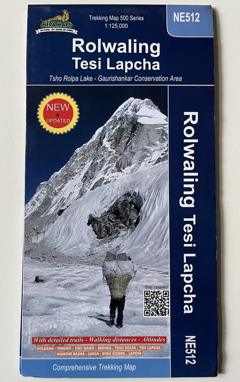
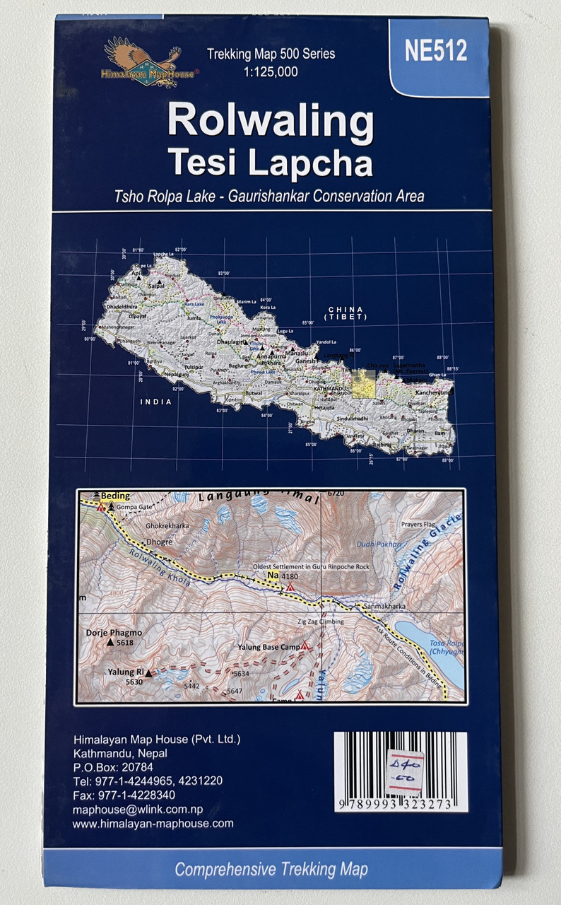
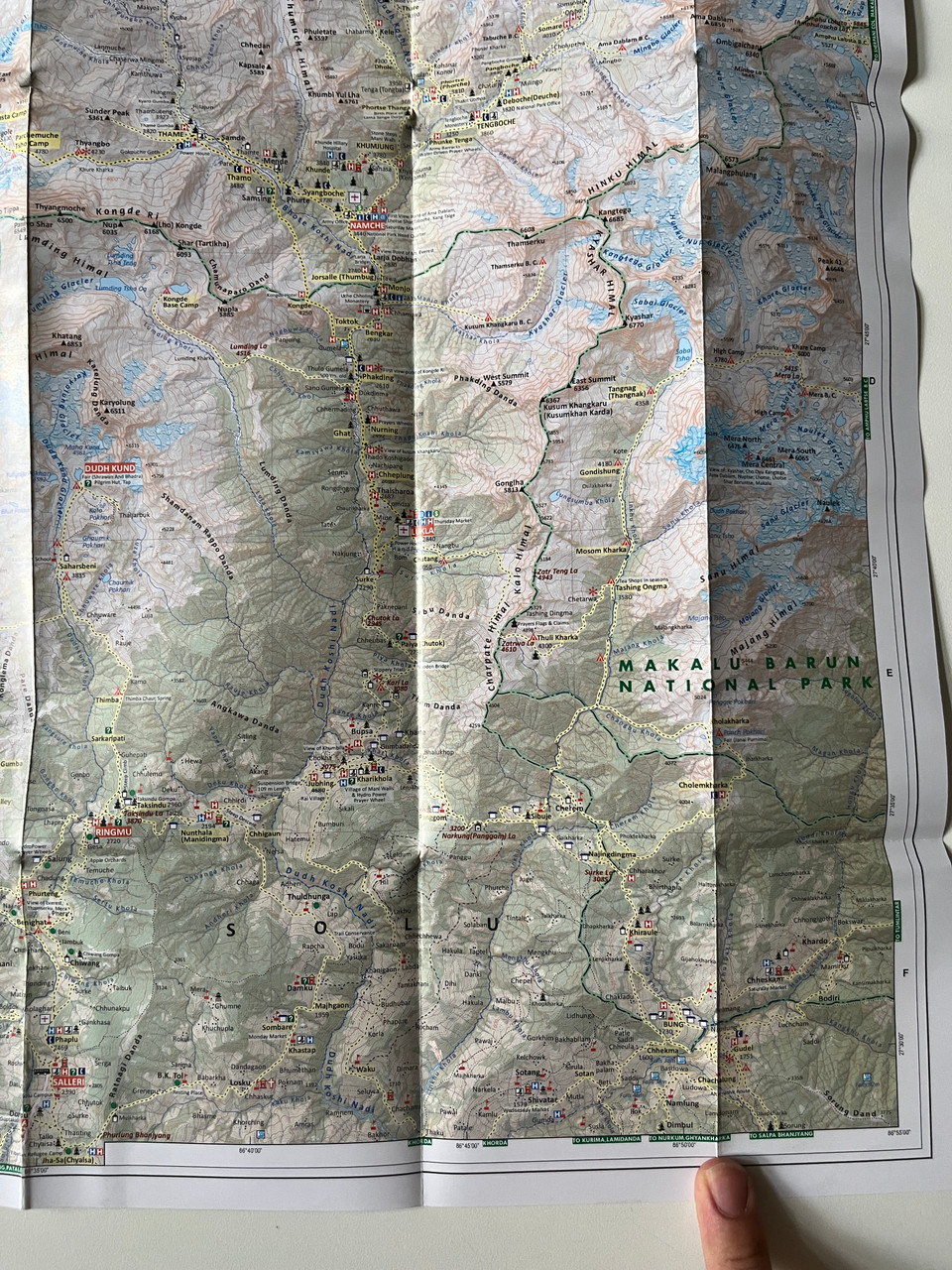
Rolwaling Tesi Lapcha / Tsho Rolpa Lake - Gaurishankar Conservation Area Trekking Map (1:125,000)
Product Details:
-
Title: Rolwaling Tesi Lapcha / Tsho Rolpa Lake - Gaurishankar Conservation Area Trekking Map
-
Series: Trekking Map 500 Series
-
Map Code: NE512
-
Scale: 1:125,000
-
Coverage: Rolwaling Valley, Tesi Lapcha Pass, Tsho Rolpa Lake, Gaurishankar Conservation Area
-
Publisher: Himalayan Map House
-
ISBN-13: 9789993323273 / 978-9993323273
-
Format: Folded trekking map
-
Edition: Latest & Updated
Overview
The Rolwaling Tesi Lapcha Trekking Map (1:125,000) is a detailed and comprehensive trekking guide designed for adventurers exploring the Rolwaling Valley, Tesi Lapcha Pass, Tsho Rolpa Lake, and Gaurishankar Conservation Area. This map is part of the Trekking Map 500 Series (NE512) by Himalayan Map House, a trusted source for high-quality trekking maps in Nepal.
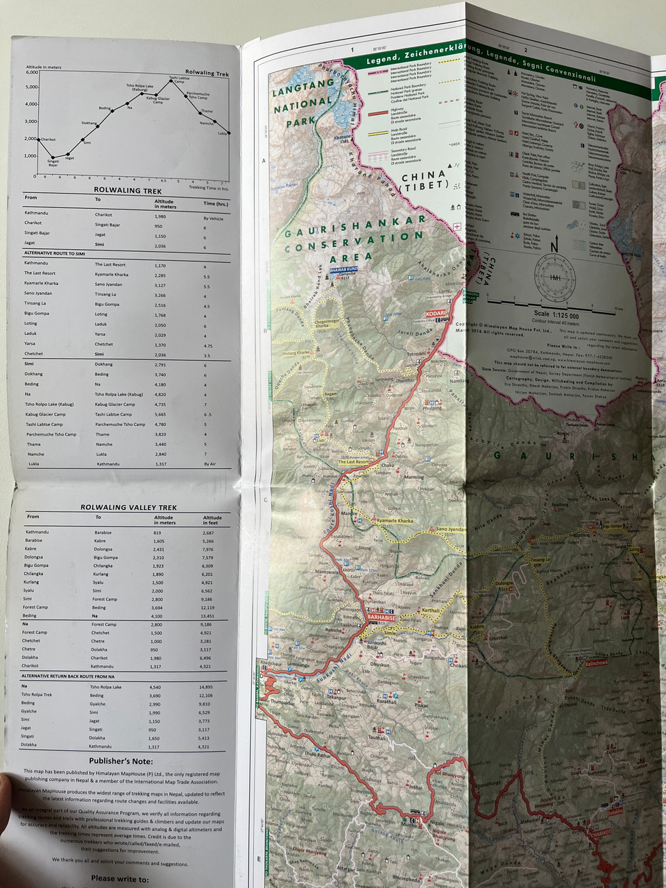
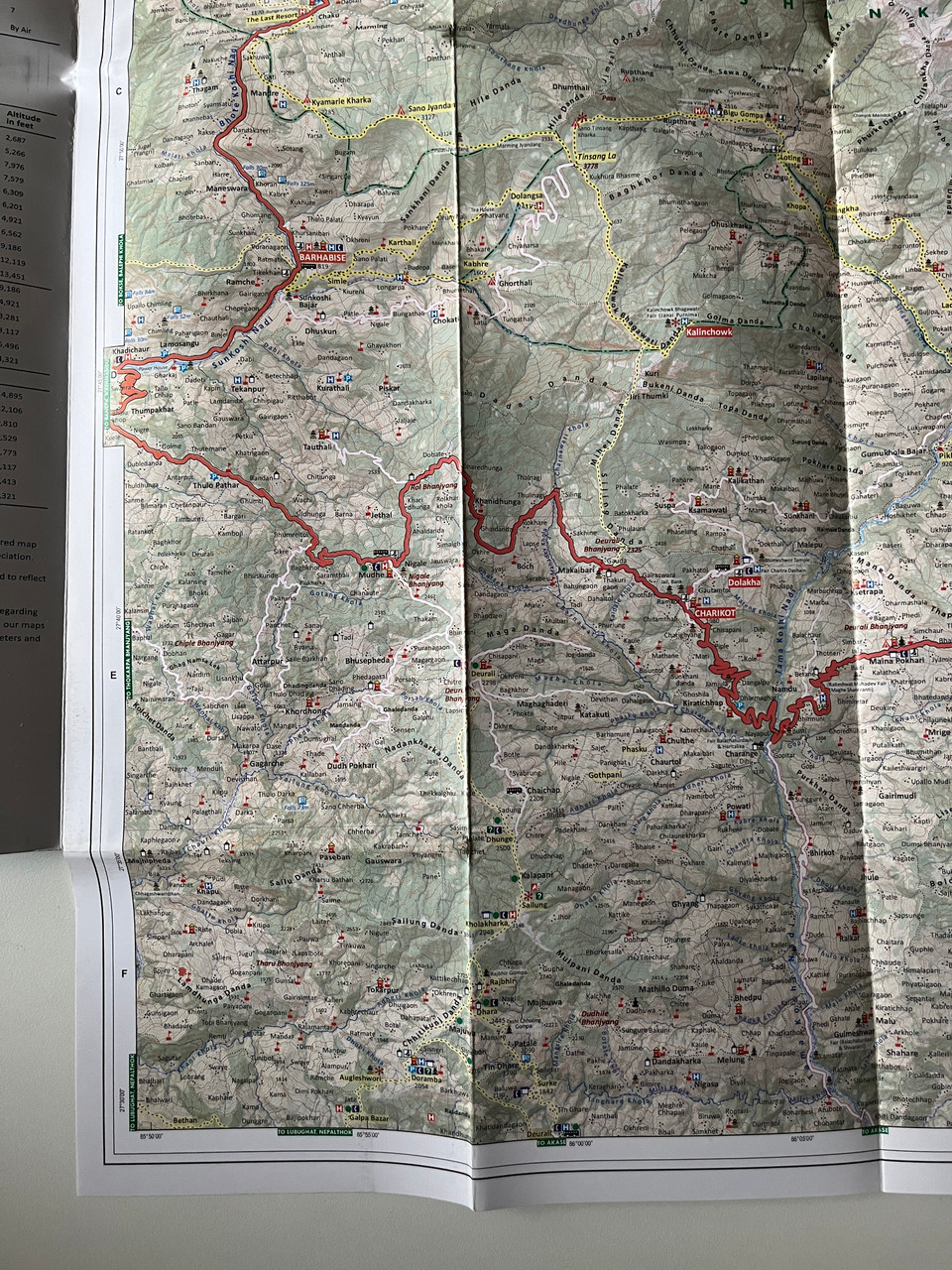
With an accurate topographical layout, this map highlights trekking trails, elevation contours, glaciers, passes, rivers, villages, and significant landmarks, making it an essential tool for trekkers, mountaineers, and expedition teams venturing into this remote Himalayan region.
The Rolwaling Valley, often referred to as the "hidden valley," offers breathtaking landscapes, glacial lakes, ancient monasteries, and unspoiled trekking routes. The Tesi Lapcha Pass (5,755m) is a challenging and technical high-altitude crossing, connecting Rolwaling with the Everest region.
Key Features
✔ Precise Trekking Routes – Covers the Rolwaling Valley, Tesi Lapcha Pass, and Gaurishankar Conservation Area.
✔ Topographic & Altitude Details – Features elevation contours, glaciers, ridgelines, rivers, and high passes.
✔ Landmarks & Cultural Highlights – Includes monasteries, villages, camping spots, and viewpoints.
✔ Tsho Rolpa Lake & Gaurishankar Conservation Area – Depicts Nepal’s largest glacial lake and surrounding protected areas.
✔ Updated & Comprehensive – Includes accurate trekking paths and geographic features for safe navigation.
✔ Compact & Durable – Lightweight, travel-friendly, and foldable for easy handling on treks.
Interesting Facts
Rolwaling Valley – Known as Nepal’s hidden valley, offering serene landscapes, waterfalls, and rich Sherpa culture.
Tesi Lapcha Pass (5,755m) – A high-altitude crossing between Rolwaling and the Everest region, requiring technical climbing skills.
Tsho Rolpa Lake – Nepal’s largest glacial lake, located at an altitude of 4,580m, with stunning turquoise waters surrounded by snowcapped peaks.
Gaurishankar Conservation Area – Named after Mt. Gaurishankar (7,134m), this protected area is home to diverse wildlife, rare orchids, and pristine forests.
Sherpa Culture & Monasteries – The region is rich in Buddhist heritage, featuring ancient monasteries, prayer flags, and traditional Sherpa settlements.
Publisher
Published by Himalayan Map House, Nepal’s leading map publisher specializing in high-quality trekking and travel maps.
We appreciate your feedback! Let us know how this map helped you on your trek.
Hashtags
#RolwalingTrek #TshoRolpaLake #TesiLapchaPass #GaurishankarConservation #NepalTrekking #RolwalingValley #HimalayanAdventure #HighAltitudeTrek #GlacierLakeNepal #HimalayanMapHouse

")
")
")
")
")
")


")
")