
")
")
")
")
")
")
")

")
")
")
")
")
")
")

Description
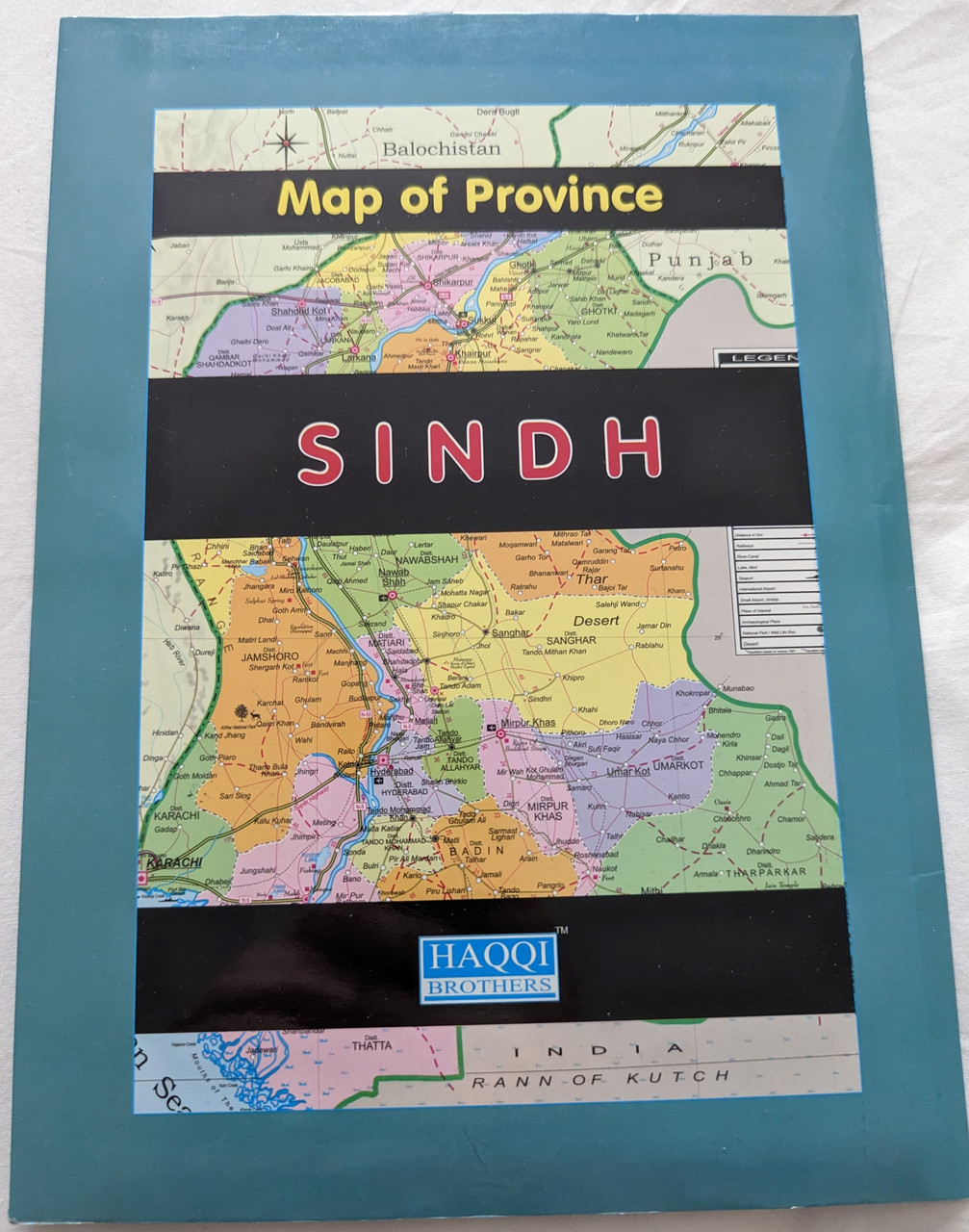
Map of Province Sindh, Pakistan | Haqqi Brothers
Product Information
-
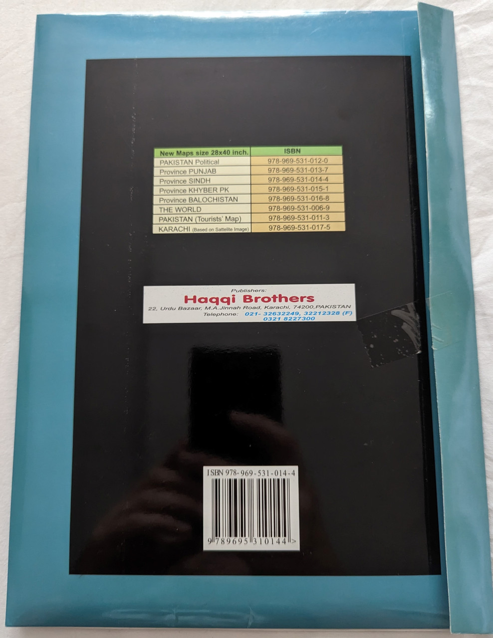
Title: Map of Province Sindh, Pakistan
-
Publisher: Haqqi Brothers
-
Format: Map
-
ISBN-10: 9695310141
-
ISBN-13: 978-9695310144 / 9789695310144
-
Language: English, Urdu, Sindhi
Overview
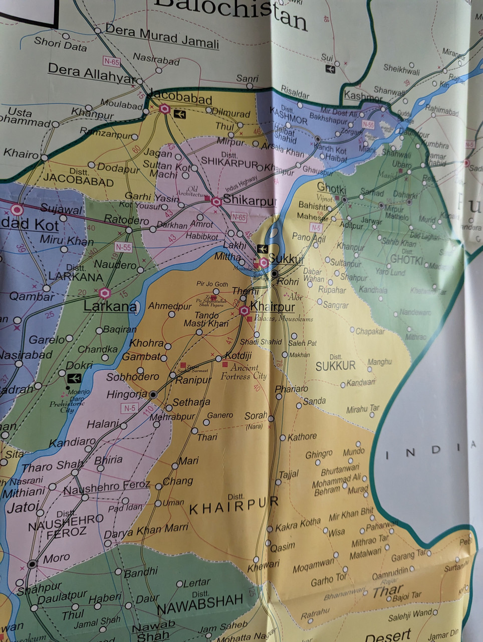
The Map of Province Sindh, Pakistan by Haqqi Brothers is a detailed and accurate cartographic representation of Sindh, one of Pakistan’s most historically and geographically significant provinces. This map provides comprehensive geographical insights into Sindh, including its topography, administrative divisions, major cities, roads, and natural features.
Sindh, located in southeastern Pakistan, is the third-largest province by land area and the second-most populous after Punjab. The province is characterized by the Indus River, alluvial plains, the Thar Desert in the east, and the Kirthar Mountains in the west. It shares borders with Balochistan, Punjab, and India while being strategically positioned along the Arabian Sea to the south.
This map is an indispensable tool for travelers, researchers, students, and policymakers, offering precise geographical representation of Sindh’s cities, districts, road networks, and natural landmarks.
Product Features
-
Highly Detailed Geographical Representation – Covers Sindh’s cities, districts, and major routes.
-
Multi-Language Annotations – Includes labels in English, Urdu, and Sindhi.
-
Covers Key Landmarks – Highlights the Indus River, Thar Desert, Kirthar Mountains, and the coastal region along the Arabian Sea.
-
Ideal for Travelers, Researchers & Academics – Essential for students, tourists, and geography enthusiasts.
-
Border & International Context – Depicts Sindh’s borders with Punjab, Balochistan, and India (Gujarat and Rajasthan).
Interesting Facts About Sindh
-
Sindh is home to Karachi, the largest city and financial hub of Pakistan.
-
Mohenjo-Daro, one of the world's oldest civilizations (Indus Valley Civilization), is located in Sindh.
-
The Indus River, Pakistan’s lifeline, runs through Sindh before emptying into the Arabian Sea.
-
Sindh has diverse landscapes, including fertile plains, deserts, and coastal regions.
-
The Thar Desert is one of the world's largest subtropical deserts.
-
Sindh’s rich cultural and linguistic diversity includes Sindhi, Urdu, and other regional languages.
Why You Need This Map
-
Perfect for Educational & Research Purposes – A must-have for geography students, researchers, and educators.
-
Essential for Travelers & Tourists – Navigate Sindh’s historical sites, cities, and roads with ease.
-
Government & Policy Planning Tool – Useful for urban planners, policymakers, and development professionals.
-
Ideal for Libraries & Institutions – A valuable addition to academic and research libraries.
Publisher Information
Haqqi Brothers is known for producing high-quality maps and geographical resources, providing accurate cartographic data for Pakistan and South Asia.
We value your feedback!
Have you used this map? Share your experience and help others discover this valuable resource!
Hashtags
#SindhMap #PakistanGeography #HaqqiBrothers #Cartography #SindhPakistan #IndusRiver #TharDesert #Karachi #PakistanTourism #EducationalResources
")
")
")
")
")
")
![Road Map of Sindh Pakistan / 1:800,000 [Map] by Survey of Pakistan](https://cdn11.bigcommerce.com/s-62bdpkt7pb/images/stencil/590x590/products/2930/7833/45-PIE9-C1AF__29806.1462823335.jpg?c=2 "Road Map of Sindh Pakistan / 1:800,000 [Map] by Survey of Pakistan")
")
")
")
")
![Sind Province Map Pakistan / Scale 1:1,000,000 [Map] by Pakistan Survey](https://cdn11.bigcommerce.com/s-62bdpkt7pb/images/stencil/590x590/products/2897/7056/26-M4H6-FUK3__14329.1462823316.jpg?c=2 "Sind Province Map Pakistan / Scale 1:1,000,000 [Map] by Pakistan Survey")
![Pakistan Physical Map / Scale 1:2,500,000 [Map] by Survey of Pakistan](https://cdn11.bigcommerce.com/s-62bdpkt7pb/images/stencil/590x590/products/3171/7002/MY-8OH0-DF6D__08057.1462823315.jpg?c=2 "Pakistan Physical Map / Scale 1:2,500,000 [Map] by Survey of Pakistan")
![Baluchistan Map Pakistan / Scale 1:1,000,000 [Map] by Pakistan Survey](https://cdn11.bigcommerce.com/s-62bdpkt7pb/images/stencil/590x590/products/3325/7177/GC-VX58-VLFB__68127.1462823319.jpg?c=2 "Baluchistan Map Pakistan / Scale 1:1,000,000 [Map] by Pakistan Survey")