")
")
")
")
")
")
")
")
")
")
")
Description
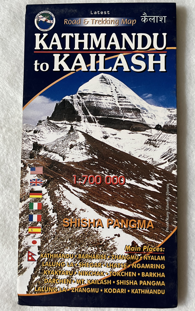
Kathmandu to Kailash | 1:700,000 | Latest Road & Trekking Map
Product Information
-
Title: Kathmandu to Kailash – Road & Trekking Map
-
Nepali Title: कैलाश
-
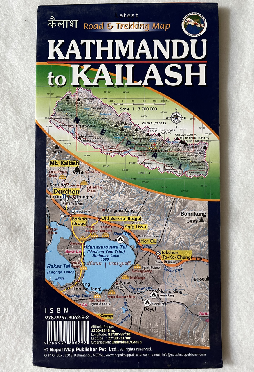
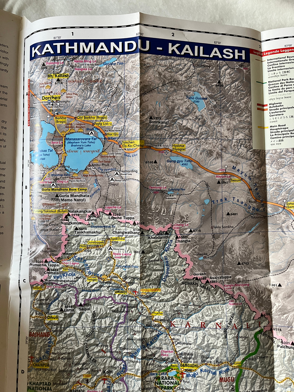
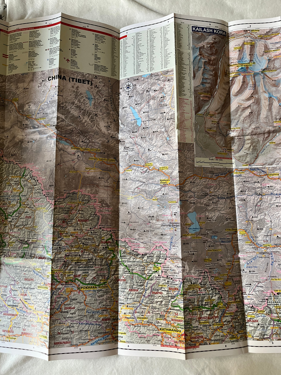
Scale: 1:700,000
-
Type: Road & Trekking Map
-
Region: Nepal-Tibet Border, Mount Kailash, Shisha Pangma
-
Publisher: Nepal Map Publisher Pvt. Ltd.
-
ISBN-13: 9789937806292 / 978-9937806292
Overview
The Kathmandu to Kailash Road & Trekking Map is an essential navigation tool for travelers, pilgrims, and trekkers journeying from Kathmandu, Nepal, to Mount Kailash in Tibet. This updated and detailed map offers accurate route information, trekking trails, and key landmarks along the sacred pilgrimage route, including Shisha Pangma, the world’s 14th highest mountain (8,027m/26,335ft).
Mount Kailash is one of the holiest mountains in the world, revered in Hinduism, Buddhism, Jainism, and Bon traditions. Pilgrims from across the globe embark on the Kailash Mansarovar Yatra, a sacred trek that involves circumambulating (kora) the mountain, believed to bring spiritual purification and enlightenment.
A must-have map for pilgrims, trekkers, and adventurers exploring the Himalayas!
Key Features
✔ Comprehensive Route Coverage – Kathmandu to Mount Kailash via key highways and trekking trails.
✔ Up-to-Date & Accurate – Latest edition with detailed topography and road information.
✔ Trekking & Pilgrimage Routes – Includes major stopovers for the Kailash Kora.
✔ Elevation Contours & Landmarks – Key passes, peaks, lakes, and sacred sites.
✔ Cultural & Religious Significance – Covers spiritual and historical aspects of Kailash.
✔ Road & Infrastructure Details – Highway connections, checkpoints, and border crossings.
Trekking & Pilgrimage Highlights Covered in the Map
Kathmandu – The starting point of the journey
Tibet Border Crossing via Kodari or Rasuwagadhi
Saga, Tibet – A key stopover for acclimatization
Lake Mansarovar – The sacred lake for ritual bathing
Mount Kailash Kora – The 52-km circumambulation trek
Darchen – The gateway to the Kailash trek
Dolma La Pass (5,630m) – The highest point of the trek
Shisha Pangma – One of Tibet’s stunning 8,000m peaks
This topographical and road map is a valuable resource for anyone planning the Kailash Mansarovar Yatra, trekking around Mount Kailash, or exploring Tibet's sacred landscapes.
Why Choose This Map?
Essential for high-altitude pilgrimage and trekking in Tibet.
Detailed topography and altitude markings for safe navigation.
Perfect for adventure travelers, spiritual seekers, and expedition teams.
Includes important travel information for road and trekking routes.
Who Should Use This Map?
✅ Pilgrims & Devotees undertaking the Kailash Mansarovar Yatra.
✅ Trekking Enthusiasts exploring the high-altitude Kailash circuit.
✅ Spiritual Seekers interested in sacred Himalayan sites.
✅ Overland Adventurers traveling from Nepal to Tibet.
Hashtags
#KathmanduToKailash #KailashMansarovar #TibetTravel #NepalToTibet #PilgrimageTrek #HimalayanAdventure #ShishaPangma #SacredMountains #TrekkingMap #KailashKora

")
")
")
")
")
")
")
")
")
")
")
")
")
")
")
")
")