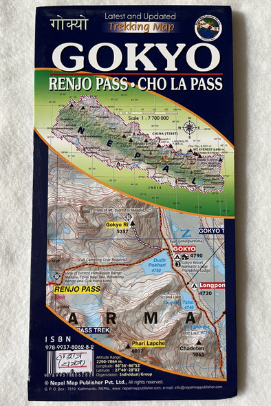
Description
Island Peak (Imja Tse) Climbing Map
Sagarmatha National Park | Scale 1:40,000 | Nepal Map Publisher Pvt. Ltd.
Product Details
-
Title: Island Peak (Imja Tse) Climbing Map
-
Coverage: Island Peak (Imja Tse), Sagarmatha National Park
-
Scale: 1:40,000
-
Publisher: Nepal Map Publisher Pvt. Ltd.
-
Edition: Latest and Updated
-
ISBN: 9789937806299
-
Language: English & Nepali
-
Material: Waterproof and tear-resistant
-
Best For: Mountaineers, trekkers, climbers, and adventure travelers
Overview
This detailed and updated climbing map of Island Peak (Imja Tse) is an essential resource for climbers and trekkers heading towards this famous 6,189m (20,305 ft) Himalayan peak. Located in Sagarmatha National Park, Island Peak is one of Nepal’s most popular trekking peaks, often climbed as part of Everest Base Camp and Three Passes Treks.
Published by Nepal Map Publisher Pvt. Ltd., this 1:40,000 scale map highlights climbing routes, glacier crossings, high passes, base camps, lodges, and trekking trails. The terrain details, altitude markers, and safety features make it a reliable companion for climbers aiming to summit this iconic Himalayan peak.
नेपाली अनुवाद - परिचय
यो इम्जा त्से (आइल्यान्ड पिक) को विस्तृत पर्वतारोहण नक्सा हो, जसले चढाइ मार्गहरू, हिमनदी पार गर्ने स्थानहरू, आधार शिविरहरू, र मुख्य पदयात्रा मार्गहरू समेट्छ।
सगरमाथा राष्ट्रिय निकुञ्जभित्र पर्ने ६,१८९ मिटर अग्लो इम्जा त्से नेपालकै लोकप्रिय ट्रेकिङ पिकमध्ये एक हो, जसलाई प्रायः एभरेस्ट आधार शिविर ट्रेक वा थ्री पास ट्रेक को रूपमा आरोहण गरिन्छ।
यो १:४०,००० स्केलको नक्सा नेपाल म्याप पब्लिशर प्रा. लि. द्वारा प्रकाशित गरिएको हो।
Key Features
✔ Comprehensive Climbing & Trekking Coverage – Covers Sagarmatha National Park, Island Peak Base Camp, and Khumbu Glacier routes
✔ Summit Route Details – Includes ascent routes, altitude markers, crevasses, and high passes
✔ Everest Region Highlights – Features Lobuche, Dingboche, Chhukung, and other important trekking stops
✔ High-Altitude Safety & Navigation – Shows safe routes, emergency shelters, and acclimatization points
✔ Waterproof & Tear-Resistant – Built for harsh mountain conditions
✔ Cultural & Natural Heritage – Highlights Buddhist monasteries, Sherpa villages, and Sagarmatha National Park landmarks
Interesting Facts
Island Peak – A Gateway to High-Altitude Climbing
-
Island Peak (Imja Tse) was first climbed in 1953 by Tenzing Norgay and British climbers, as part of their Everest expedition training.
-
The peak is called "Island Peak" because it appears like an island in a sea of ice when viewed from Dingboche.
-
The normal climbing route involves a challenging glacier traverse, steep ice walls, and technical rope climbing.
-
Climbers can experience breathtaking panoramic views of Lhotse (8,516m), Makalu (8,485m), Ama Dablam (6,812m), and Baruntse (7,129m) from the summit.
-
Sagarmatha National Park, home to Island Peak, is a UNESCO World Heritage Site rich in Sherpa culture and Himalayan wildlife.
नेपाली अनुवाद - रोचक तथ्यहरू
इम्जा त्से – उच्च हिमाली आरोहणको ढोका
-
इम्जा त्से (आइल्यान्ड पिक) १९५३ मा तेन्जिङ नोर्गे र ब्रिटिश आरोहीहरूले पहिलो पटक आरोहण गरेका थिए।
-
यस पिकलाई "आइल्यान्ड पिक" भन्ने कारण यो डिङबोचेबाट हेर्दा हिउँको समुद्रमा एउटा टापुजस्तो देखिन्छ।
-
सामान्य आरोहण मार्गमा हिमनदी पार गर्ने, ठाडो बरफ पर्खाल चढ्ने, र डोरीको प्रयोग आवश्यक पर्ने प्रविधिक मार्गहरू समावेश छन्।
-
चुचुरोबाट ल्होत्से (८,५१६ मि), मकालु (८,४८५ मि), आमादब्लम (६,८१२ मि), र बारुन्त्से (७,१२९ मि) को अद्भुत दृश्यहरू देख्न सकिन्छ।
-
सगरमाथा राष्ट्रिय निकुञ्ज, जहाँ इम्जा त्से अवस्थित छ, UNESCO विश्व सम्पदा सूचीमा सूचीकृत क्षेत्र हो।
Publishers
Published by Nepal Map Publisher Pvt. Ltd., a trusted source for high-quality climbing and trekking maps of the Himalayas.
We value your feedback!
If you’ve used this map, please share your experience. Your review helps other climbers and trekkers plan their adventure!
Hashtags
#IslandPeak #ImjaTse #NepalClimbing #SagarmathaNationalPark #TrekkingNepal #EverestRegion #SherpaCulture #UNESCOWorldHeritage #ClimbingMap #HimalayaExpedition


