")
")
")
")
")
")
")
")
")
")
")
")
")
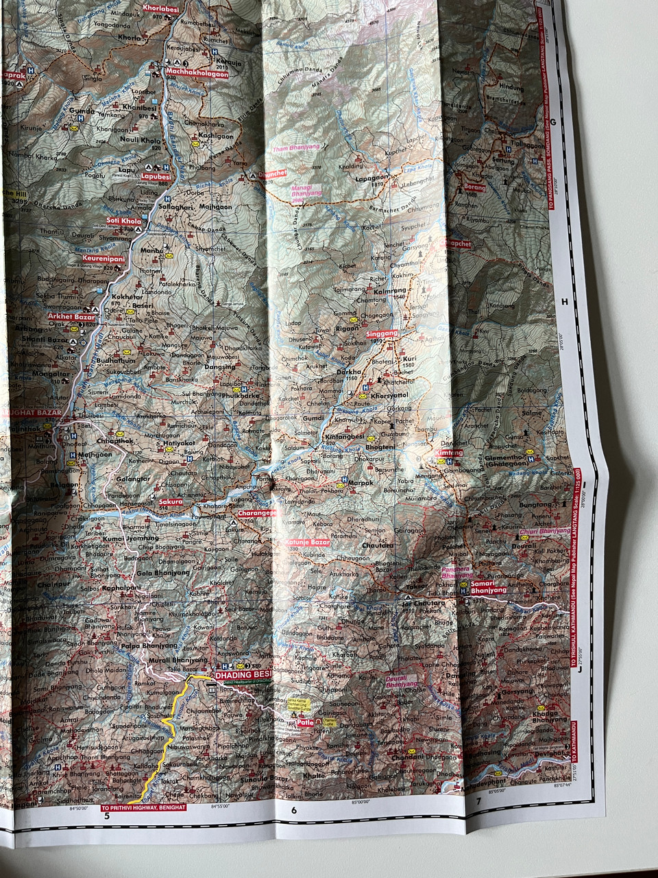
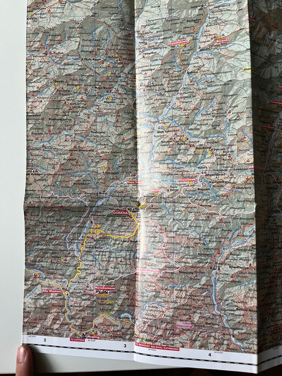
Description
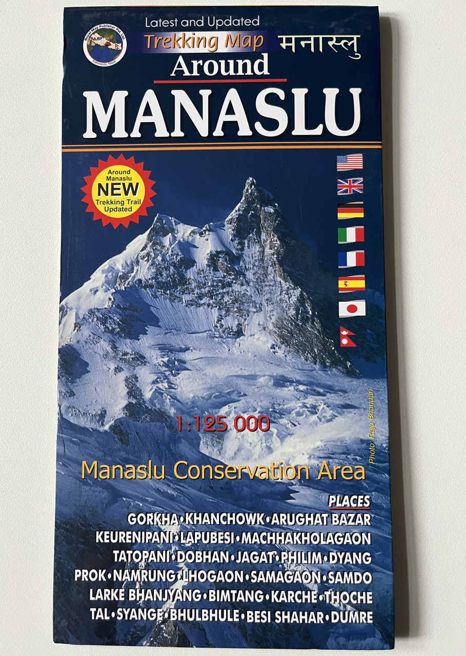
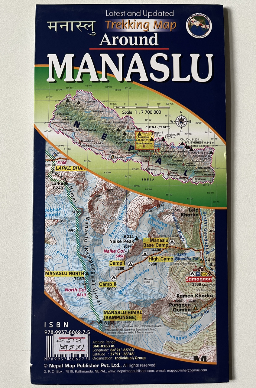
Around Manaslu Trekking Map (1:125,000) | Nepal Map Publisher Pvt. Ltd.
Product Details:
-
Title: Around Manaslu Trekking Map
-
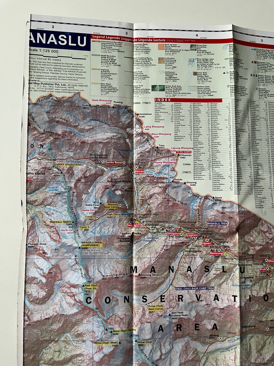
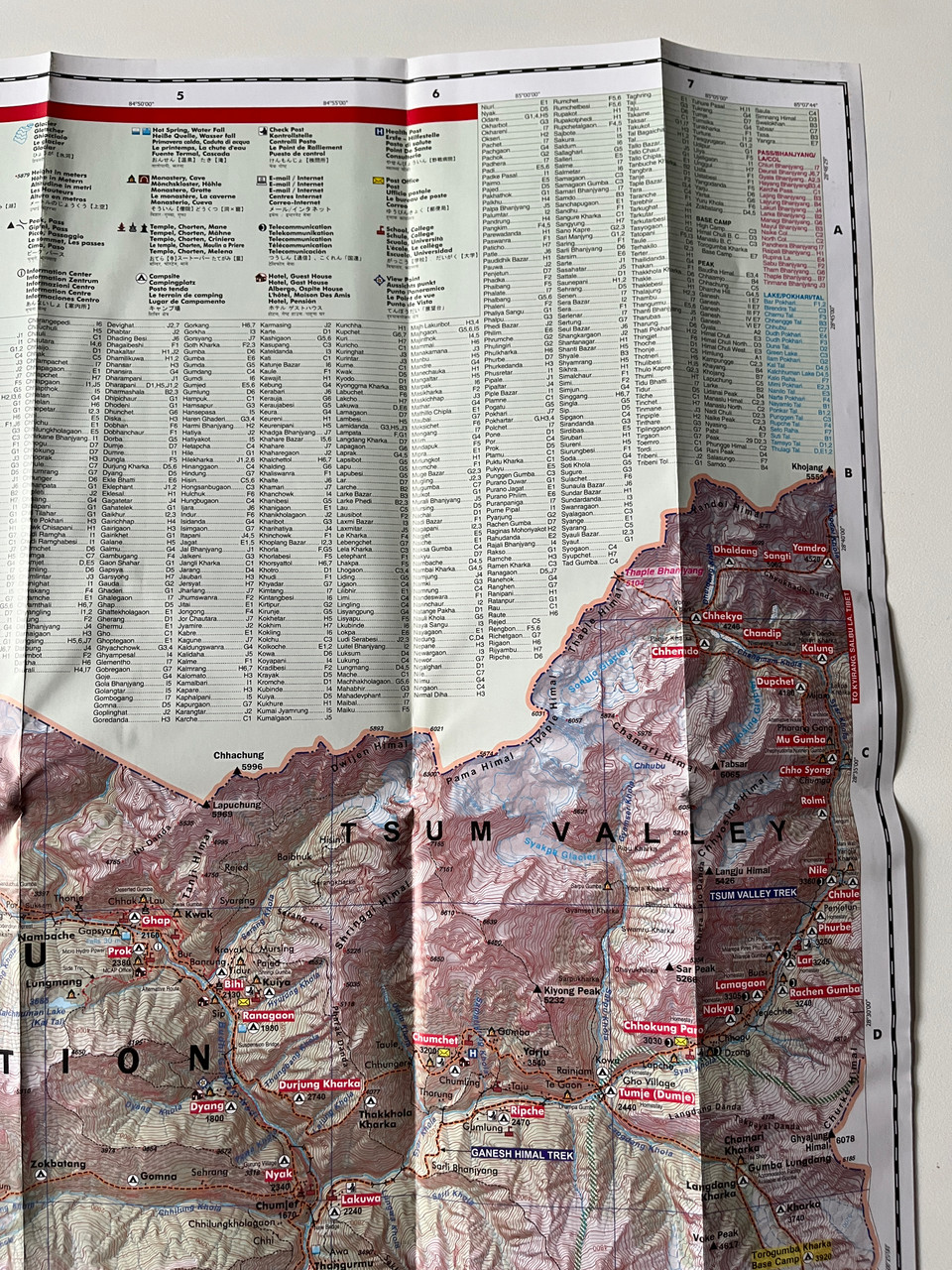
Scale: 1:125,000
-
Coverage: Manaslu Conservation Area, Larkya La Pass, Samagaun, Jagat, Dharmasala, Bimtang, and surrounding trekking routes
-
Publisher: Nepal Map Publisher Pvt. Ltd.
-
ISBN-13: 9789937806275 / 978-9937806275
-
Format: Folded trekking map
-
Edition: Latest & Updated
-
Language: English & Nepali
-
Features: Detailed topographic information, trekking routes, and altitude profiles
Overview
The Around Manaslu Trekking Map (1:125,000) is an essential guide for trekkers exploring the breathtaking Manaslu Circuit. Covering the Manaslu Conservation Area, this detailed and updated trekking map highlights the entire Manaslu Circuit, including key villages, altitudes, rivers, glaciers, and high mountain passes.
The Manaslu Circuit Trek is one of Nepal’s most stunning and remote trekking routes, offering unparalleled views of Mount Manaslu (8,163m), the eighth-highest peak in the world. It passes through culturally rich Tibetan-influenced villages, rhododendron forests, glacial rivers, and high-altitude landscapes. The challenging Larkya La Pass (5,106m) is the trek’s highest point, providing spectacular panoramic views of the Himalayas.
This durable and easy-to-carry trekking map ensures a safe and well-informed adventure through one of Nepal’s most adventurous and less crowded trekking routes.
Key Features
✔ Highly Accurate & Up-to-Date – Covers the full Manaslu Circuit and its alternative trekking routes.
✔ Topographic & Altitude Details – Includes elevation contours, glaciers, ridgelines, and rivers.
✔ Trekking Routes & Key Stops – Covers Samagaun, Samdo, Larkya La Pass, Dharmasala, Jagat, and Bimtang.
✔ Manaslu Conservation Area – Showcases rich biodiversity, remote landscapes, and cultural heritage.
✔ Weather-Resistant & Travel-Friendly – Foldable and durable for easy use on treks.
✔ Ideal for Independent & Guided Trekkers – Essential for both solo and group trekking experiences.
Interesting Facts
Mount Manaslu (8,163m) – Known as the "Mountain of the Spirit," it is the eighth-highest peak in the world.
Larkya La Pass (5,106m) – A challenging and rewarding high mountain pass offering spectacular Himalayan panoramas.
Samagaun & Samdo Villages – Remote Tibetan Buddhist settlements, known for ancient monasteries and rich cultural traditions.
Manaslu Conservation Area – Home to rare wildlife species such as the snow leopard, red panda, and Himalayan tahr.
Fewer Crowds, More Adventure – Unlike Everest or Annapurna treks, the Manaslu Circuit is less crowded, offering a more authentic Himalayan experience.
Publisher
Published by Nepal Map Publisher Pvt. Ltd., a trusted source for accurate and high-quality trekking maps in Nepal.
We’d love to hear your trekking experiences! Share your feedback and let us know how this map helped on your journey.
Hashtags
#ManasluTrek #ManasluCircuit #TrekkingNepal #ManasluConservationArea #LarkyaLaPass #NepalHiking #HimalayanAdventure #ManasluBaseCamp #TrekkingMaps #HimalayanTrekking
")
")


")
")
")
")
 5416 m. Latest and Updated Trekking Map अन्नपूर्ण Nepal Map Publisher Pvt. Ltd. (9789937806220)")
 5416 m. Latest and Updated Trekking Map अन्नपूर्ण Nepal Map Publisher Pvt. Ltd. (9789937806220)")
")
")
")


")
")