Description
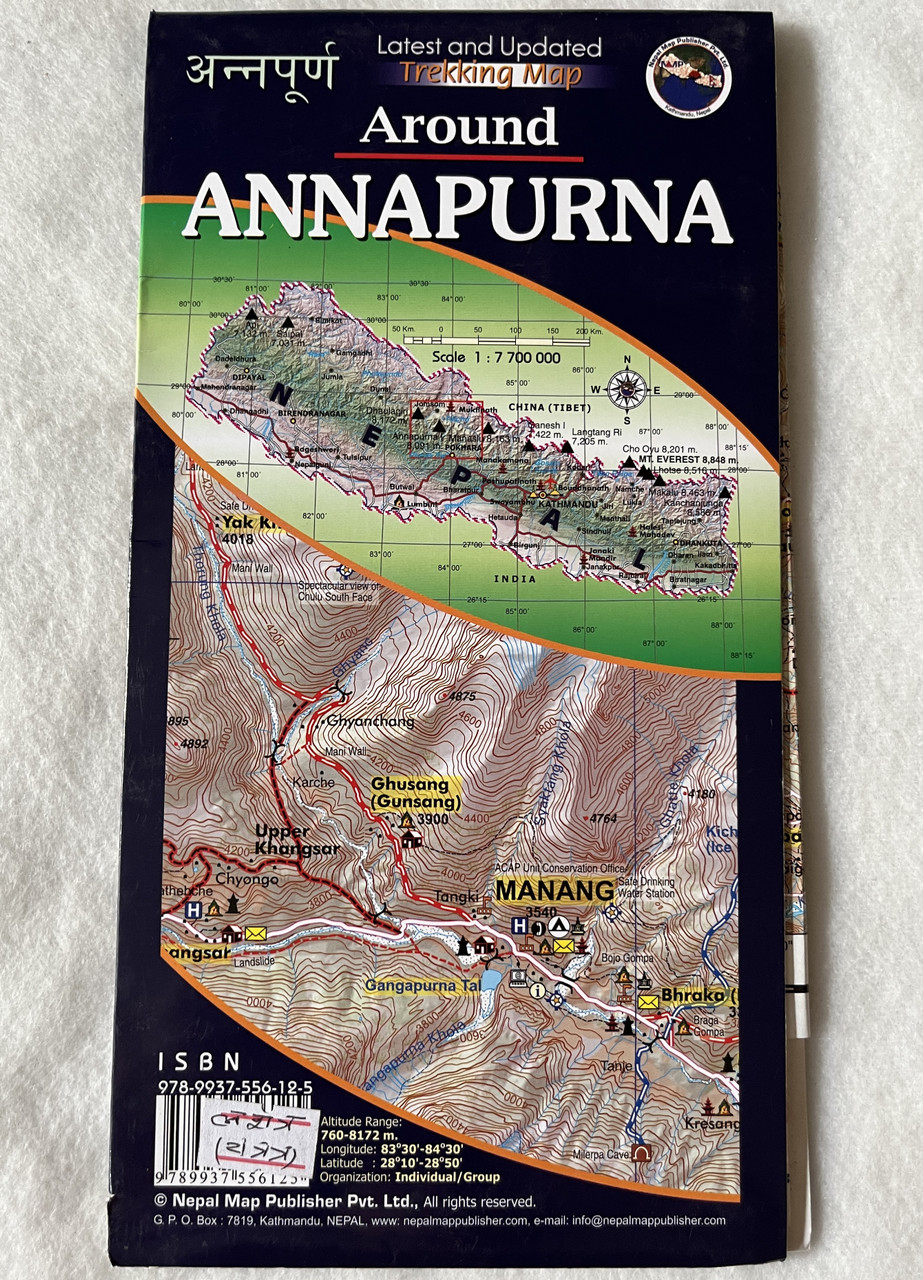
Around Annapurna Trekking Map
Annapurna Conservation Area | Scale 1:80,000 | Nepal Map Publisher Pvt. Ltd.
Product Details
-
Title: Around Annapurna Trekking Map
-
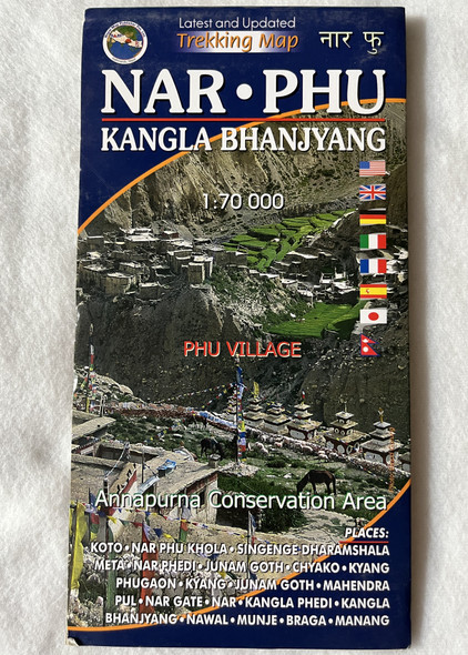
Coverage: Annapurna Circuit, Annapurna Conservation Area (ACA), Thorong La Pass, Manang, Mustang, Jomsom, Muktinath
-
Scale: 1:80,000
-
Publisher: Nepal Map Publisher Pvt. Ltd.
-
Edition: Latest and Updated
-
ISBN: 9789937556125
-
Language: English & Nepali
-
Material: Waterproof and tear-resistant
-
Best For: Trekkers, hikers, and adventurers exploring the Annapurna Circuit
Overview
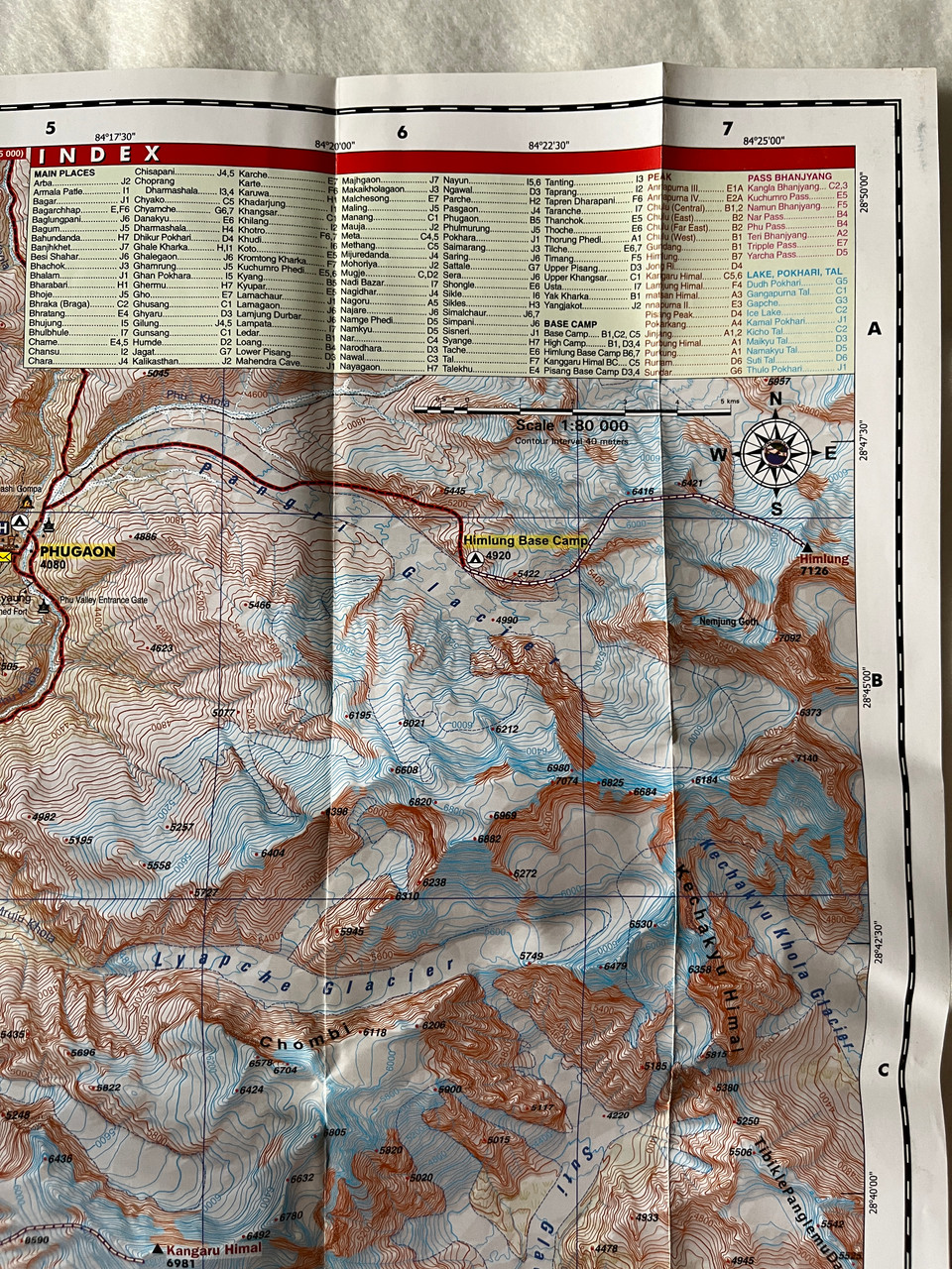
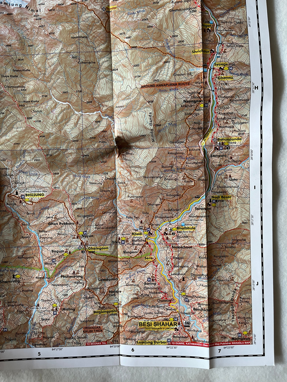
The Around Annapurna Trekking Map is an essential guide for exploring one of Nepal’s most famous trekking routes, the Annapurna Circuit. Covering the Annapurna Conservation Area (ACA), this 1:80,000 scale map provides highly detailed trail routes, altitude markers, trekking lodges, viewpoints, and key cultural and natural landmarks.
The Annapurna Circuit is renowned for its breathtaking landscapes, high-altitude passes, and diverse terrain, from subtropical forests to the alpine desert of Mustang. This latest edition trekking map is waterproof and durable, perfect for navigating challenging terrains, including Thorong La Pass (5,416m), Manang, Jomsom, Muktinath, and Poon Hill.
नेपाली अनुवाद - परिचय
यो अन्नपूर्ण क्षेत्रको पदयात्रा मार्गहरूको विस्तृत नक्सा हो, जसमा अन्नपूर्ण सर्किट, थोरोंगला पास, मनाङ, जोमसोम, मुक्तिनाथ लगायतका प्रमुख स्थलहरू समावेश छन्।
१:८०,००० स्केलको यो नवीनतम संस्करण नक्सा पदयात्रा मार्गहरू, लजहरू, उचाइ चिन्हहरू, प्राकृतिक स्थलहरू, र सांस्कृतिक विशेषताहरू सहित पूर्ण जानकारी प्रदान गर्दछ।
Key Features
✔ Covers Entire Annapurna Circuit & Side Routes – Includes Thorong La Pass, Tilicho Lake, Jomsom, Muktinath, and Ghorepani Poon Hill
✔ Altitude Markers & Trekking Information – Provides elevation details, distance markers, and acclimatization points
✔ Cultural & Religious Landmarks – Highlights Muktinath Temple, Buddhist monasteries, and local villages
✔ Natural Highlights – Covers Annapurna Conservation Area’s diverse landscapes, waterfalls, and high-altitude lakes
✔ Waterproof & Durable – Designed for all-weather trekking conditions
✔ Easy Navigation – Features detailed trekking routes, alternative paths, and emergency exit points
Interesting Facts
Annapurna Circuit – A Trek of a Lifetime
-
The Annapurna Circuit is one of the most famous long-distance treks in the world, covering 160-230 km, depending on the route.
-
Thorong La Pass (5,416m) is one of the highest trekking passes in the world, offering stunning Himalayan views.
-
The trek passes through diverse climatic zones, from lush subtropical forests to the dry Mustang region, giving trekkers a unique experience of Nepal’s varied landscapes.
-
Tilicho Lake (4,919m), one of the highest altitude lakes in the world, is an optional side trek for adventurous hikers.
-
The trek is rich in culture, with Gurung, Thakali, and Tibetan Buddhist influences, evident in the monasteries, chortens, and traditional villages.
-
Muktinath Temple, an important pilgrimage site for both Hindus and Buddhists, is a major highlight of the circuit.
नेपाली अनुवाद - रोचक तथ्यहरू
अन्नपूर्ण सर्किट – जीवनभर सम्झनलायक यात्रा
-
अन्नपूर्ण सर्किट विश्वकै सर्वाधिक चर्चित लामो दूरीको पदयात्रा मार्ग मध्ये एक हो, जसको लम्बाइ १६०-२३० किमी सम्म हुन्छ।
-
थोरोंगला पास (५,४१६ मि) विश्वकै उच्च पदयात्रा पासहरूमध्ये एक हो, जहाँबाट मनोरम हिमाली दृश्य देख्न सकिन्छ।
-
पदयात्रा गर्दा भू-परिवेशमा ठूला भिन्नता देख्न पाइन्छ – सबस्पटिय जंगलहरूदेखि लिएर उच्च हिमाली मरुभूमि (मुस्ताङ क्षेत्र) सम्मको अनुभव गर्न सकिन्छ।
-
तिलिचो ताल (४,९१९ मि) संसारकै सबैभन्दा अग्लो स्थानमा रहेको तालहरूमध्ये एक हो।
-
गुरुङ, थकाली, र तिब्बती बौद्ध संस्कृति पाइने यस क्षेत्रमा परम्परागत गाउँहरू, गुम्बाहरू, र चोर्टेनहरू मुख्य आकर्षण हुन्।
-
मुक्तिनाथ मन्दिर, हिन्दू र बौद्ध धर्मावलम्बीहरूको पवित्र स्थल, यात्राका प्रमुख विशेषताहरू मध्ये एक हो।
Publishers
Published by Nepal Map Publisher Pvt. Ltd., a trusted provider of detailed trekking and travel maps in Nepal.
We value your feedback!
Have you used this map for your trek? Leave a review to help fellow adventurers plan their journey!
Hashtags
#AnnapurnaCircuit #AnnapurnaTrek #NepalTrekking #ThorongLaPass #Muktinath #TilichoLake #TrekkingNepal #ExploreAnnapurna #AdventureTravel #HimalayanTrekking


